26. - 28. July 2020, 55 km
Day 1
Ytri Rangá - Áfangagil
15 km
My alarm went off at 5:45 AM. I quickly ate breakfast to catch the bus to Landmannalaugar at 7:00 AM. Halfway, I asked the bus driver if he could stop somewhere in the middle of nowhere (along road 26) to let me out. He kindly agreed, and I started walking the first stretch of the 55 km to Landmannalaugar.
This trek officially starts at Leirubakki, but the first 25 km to Rjúpnavellir didn’t seem very attractive to me, as they looked flat and monotonous (though I may be wrong). So I decided to start at Rjúpnavellir, or actually a bit further, at the bridge over the river Ytri Rangá.
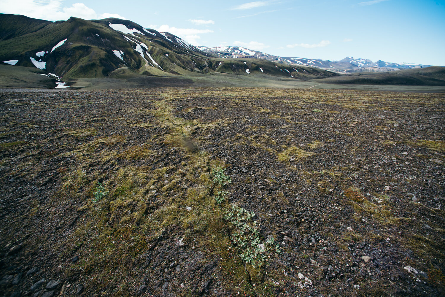
The route begins along the banks of the Ytri Rangá and continues up and down through a series of valleys. In the first valley, I encountered a river that had to be waded. After a beautiful waterfall (Rangárbotnar), the landscape quickly became less vegetated, and the soil turned loose. It was really beautiful to walk across the light-coloured pumice fields of Hekla.
At the source of the Ytri Rangá, I filled my water bottle, as I wouldn’t encounter any more water until the hut at Áfangagil. From there, the trail passed a huge lava field and then crossed the road to Landmannalaugar (F225). To reach the hut and campsite, the track climbed one final hill (approximately 70 m), and the hut only came into view at the very last moment.


Day 2
Áfangagil - Landmannahellir
22 km
I knew this would be the longest day of the trek, so I got up as soon as the sun started warming up my tent. The trail began with a 120 m climb and continued through long stretches of lunar landscapes. One of the barren valleys is even called Death Valley by some. Despite the lack of vegetation, flocks of sheep were scattered here and there, searching for something to eat (you generally meet more sheep than people here).
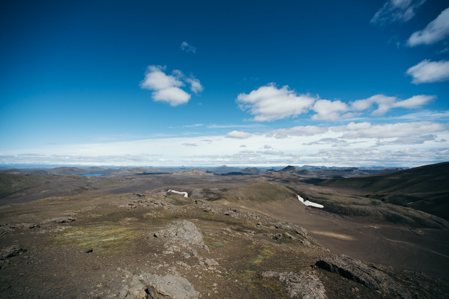
In the middle of the black sand and ash plains, I came upon Valagjá, an explosion fissure that looked completely otherworldly. The weather was perfect, and from higher elevations I could see all the way to Kerlingarfjöll and Hofsjökull.
From Valagjá, it wasn’t far to the river Helliskvísl. River crossings can be enjoyable, but for me they’re always a bit stressful. Luckily, there wasn’t much water in Helliskvísl, so it was easy to cross. This was also the halfway point for the day. Helliskvísl was the first place with drinkable water after Áfangagil (though the river did contain some sediment).
After a long break, I continued along the trail, which first crossed a lava field already covered by one of my favourite organisms, Racomitrium lanuginosum (Woolly fringe moss), a species that softens sharp lava with a velvety green blanket. Then came endless black sandy plains, which were tiring on the feet.
When Mount Hrafnabjörg appeared on my left, I knew it was time to cross a vast, nearly vegetation-free valley. A small river flowed from one side toward the centre and disappeared underground. From there, I had views of several large lakes, including Sauðleysuvatn, Hrafnabjargavatn, and later Herbjarnafellsvatn.
Between Sauðleysuvatn and Hrafnabjargavatn, I had to cross another small stream, also called Helliskvísl. The last climb of the day (around 220 m) felt tough, but it was the final one and followed by a long descent to Landmannahellir. Here, there’s a hut and a campsite. When I arrived, it was quite busy, which was good preparation for Landmannalaugar but also a bit of a shock after two quiet days of hiking alone.


Day 3
Landmannahellir - Landmannalaugar
16 km
Heavy legs. Even though I run regularly, my body clearly wasn’t prepared to carry an extra 30 percent of its weight for three days in a row. The first kilometre would have taken me over a ridge, climbing about 100 m, but knowing there would be more elevation later in the day, I decided to take a detour and head straight to Löðmundarvatn. It turned out to be a day for shorts and a T-shirt (which I obviously hadn’t brought). There was no wind, and the temperature must have been around 14°C. The reflections in Löðmundarvatn were stunning, but there were also flies buzzing into my nose and behind my glasses. Just before crossing road 225 to Landmannalaugar again, I passed what looked like frost wedges. The landscape began to change, and in the distance I could see the rhyolite mountains of Landmannalaugar. This day would take me over the highest point of the trek (around 800 m above sea level) and involved a long, steady climb. I always try to walk uphill in a kind of meditative state, very slowly, without stopping, just focusing on the next step. It works for me. It also helped that each climb was rewarded with stunning views (from the highest point, I could even see Vatnajökull). From there, it was a long descent to Landmannalaugar, although the final kilometre through the lava field seemed to take forever. I stayed another night at Landmannalaugar, since my bus wouldn’t leave until 15:30 the next day. If I had gotten up early and felt fresh, I would have hiked to Grænihryggur, as this wasn’t my first time in Landmannalaugar. But I only made it about one kilometre past Skalli. Still, it was fantastic to see the colours in the rhyolite mountains again.


Tips
55 km, 3 days (or ca. 82 km in 4 days if extended to Leirubakki). It ends at Landmannalaugar, so you can keep walking Laugavegur all the way to Þórsmörk or Skógar.
Where to sleep
Tent or in the huts, both for a fee.
Áfangagil
Landmannahellir
Landmannalaugar
Wild camping is not allowed in the Fjallabak Nature Reserve (which starts between the Helliskvísl crossing and Landmannahellir), so it would only be possible along the Ytri Rangá or at Helliskvísl if you need direct access to water.
Maps
I used an Iceland guide about the route with some more detailed small maps, in addition to a map, compass and the app OsmAnd with an offline map including elevation and a .gpx track of the route. The maps only have a scale of 1:100.000, which is not very good. The trail is not always visible, but it is marked with white poles. I never had any problems finding the track.
Icelandic guide
Map 1
Map 2
OsmAnd
Transportation
To get from Reykjavík to the start point and to go back to Reykjavík, I booked a return ticket with Reykjavík Excursions and asked the bus driver to let me out at a specific point along the road. If he would not have been willing to do so, I would have gone out at Leirubakki and hitchhiked further to avoid walking the first stretch to Rjúpnavellir along the road (10 km) or the official Hellismannaleið (25 km).